Your Cart is Empty


Sold out
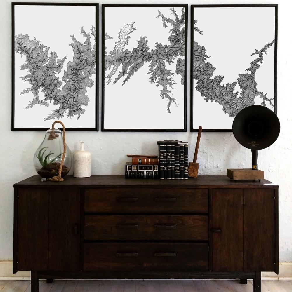
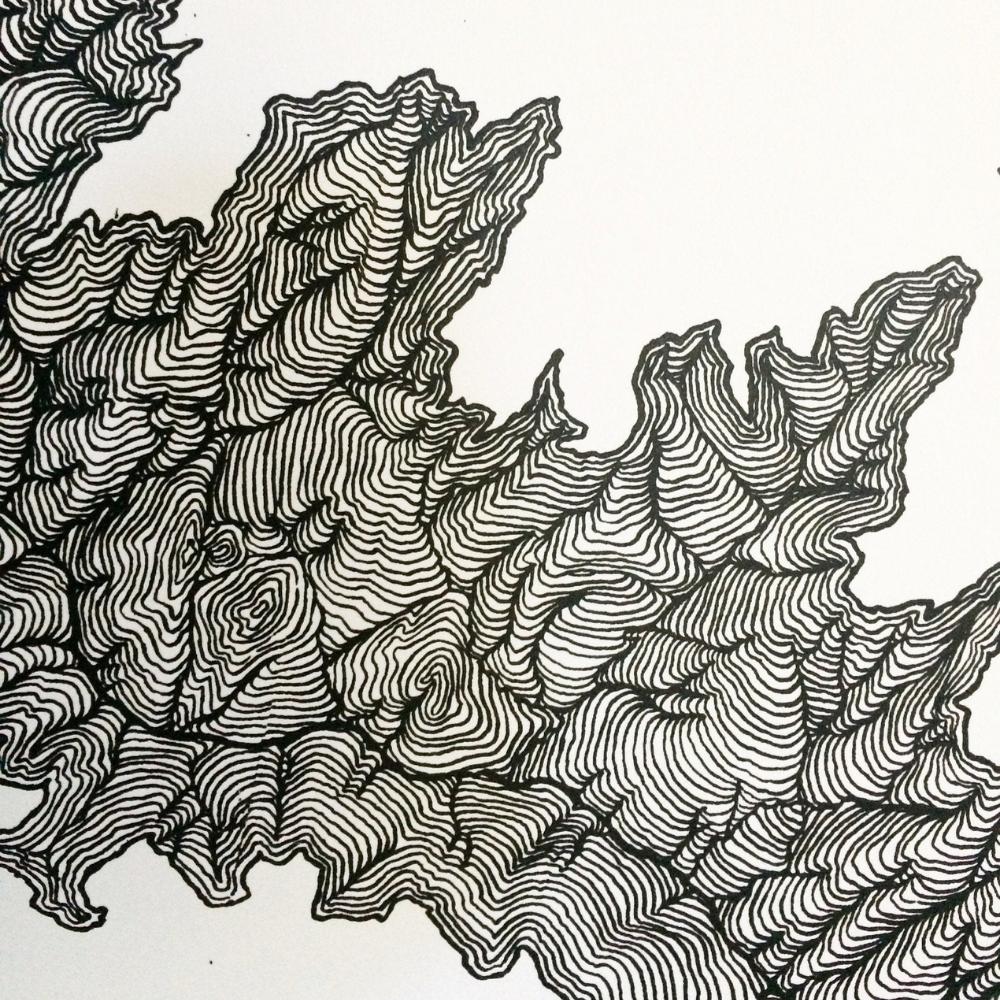
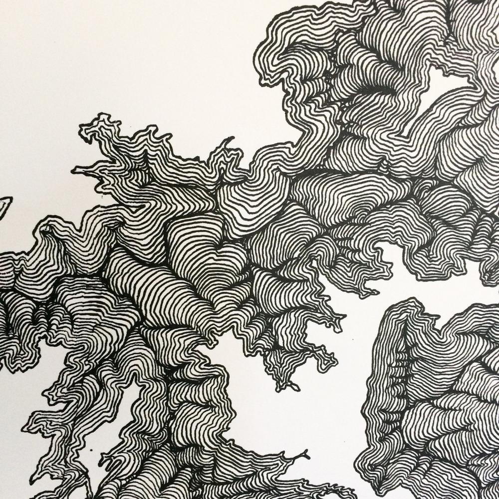
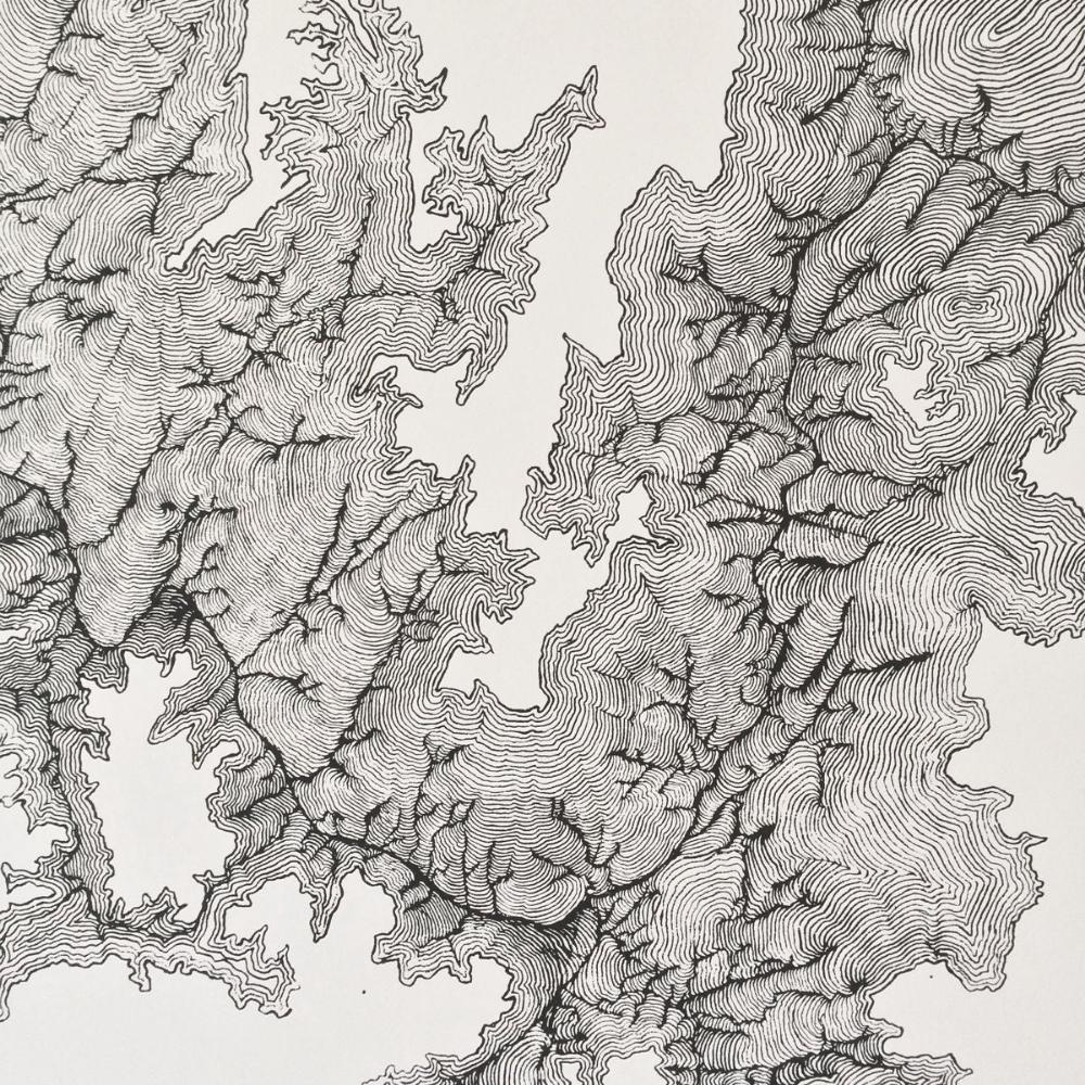
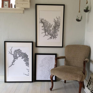
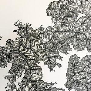
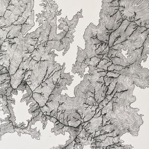
Grand Canyon Triptych Art Topographical Map
$345.00
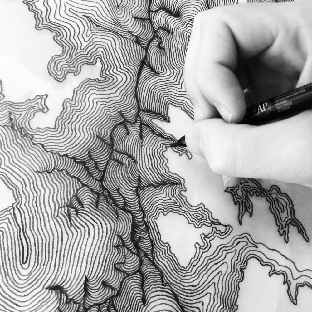
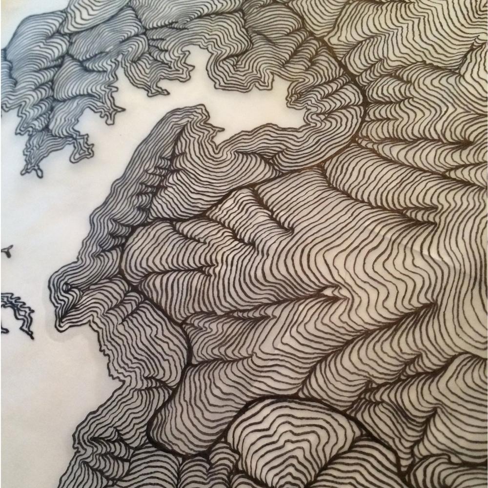
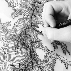
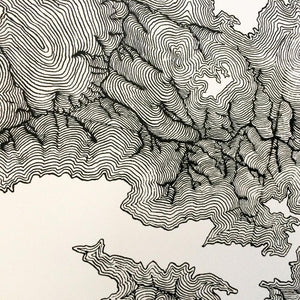
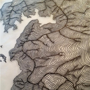
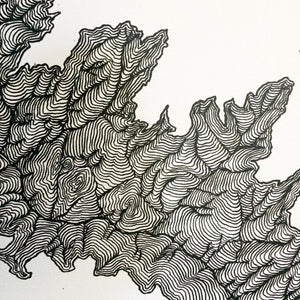
This is definitely a statement piece. This triptych of the Grand Canyon shows incredible depth of the Colorado river and all the connecting canyons that make up the Grand Canyon. The topographical lines are interpretive in order to give depth, but the actual rivers and canyons are representative of the actual canyon. The map was originally drawn by hand using satellite photography, and the prints are made using giclee printing methods.
Material: 100lb acid free paper
Type: Topographical Map
Paint: High quality archival ink
Size: Three 24x36 inches each
This product is made to order. Production time is 1 week. Ships in a sturdy tube. In order for this product to make it to you safely, frame is not included. If you would like suggestions, contact us at info@rustic.com.
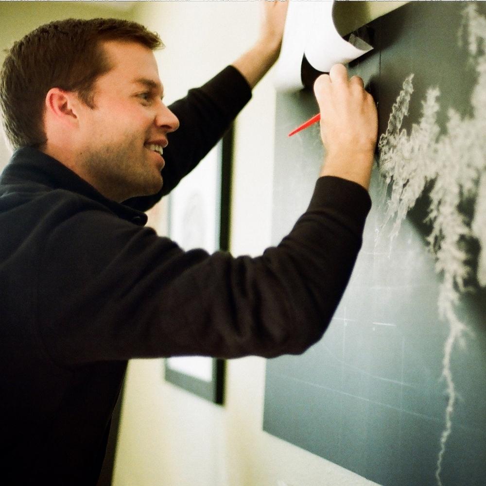
Artist Statement:
"As an artist, my purpose is to reveal the artistry that exists in nature and to present it in a way that is accessible enough to hang on a wall in your home. I also want to bring our attention to our impact on the landscapes that surround us."
Erik Linton
Proudly made in Utah


Erik Linton is on a mission as an artist is to help people see things that surround us all in a different way. He says, "The trees that surround us and out live us are constantly writing the stories of the micro and macro environments around them. From the workings of a wood ant to the global climates, these trees are full of stories." The wood gathered for making his prints is taken only from previously fallen trees. He especially likes to gather his wood and botanical samples from places that have some significance like a National Park, National Forest, or a historical site. All prints are created by hand from start to finish.
Love what you see?
Click here to view more from their collection >>